Russia is a country with a vast territory, rich nature, varied landscapes and climatic conditions. One of the most difficult tasks that always faced the local rulers was to ensure reliable communication between the various parts of their vast domains.
Infrastructure features

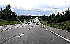
The current Russian authorities are aware of the paramount importance of transport connectivity and unity throughout the territory, although in general, the cost of the road sector in Russia is quite low compared to other developed countries. If measured as a percentage of GDP, Russia spends about 2%, while the norm for countries with a well-developed road network is at least 3%. If we measure the value of other assets - bridges, tunnels, railway lines, etc., Russia is also not among the leaders.
The pace of road construction is constrained by the difficulties traditional for Russia - weather, distances, economic underdevelopment of remote areas, etc. Economic constraints are added to the physical constraints. For example, transport arteries passing through settlements are much more expensive than others due to the preliminary acquisition of land and the need for better arrangement.
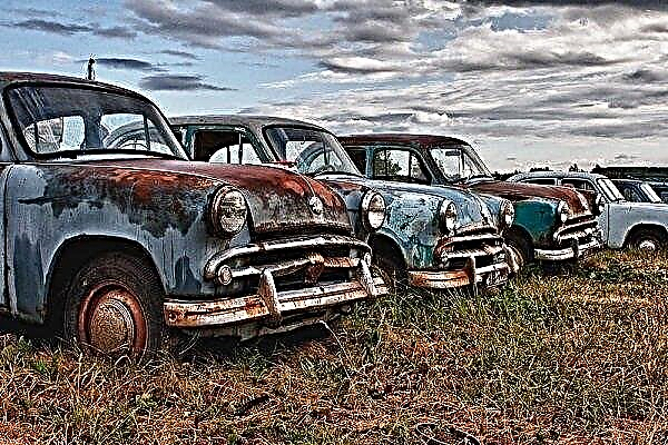
However, despite all the difficulties, road construction in Russia is a big business, which involves over 500 companies with multimillion-dollar assets. The problem is that the brightest and most expensive projects are often chosen for construction and reconstruction, while the less profitable ones are put on the shelf.
Corruption and fraud also play an unseemly role - thanks to them, roads appear on the map that do not exist in reality. And in some places, people make their own way, which the official services do not know about.
But today we want to talk not about the problems of road construction in Russia, but rather about the achievements. In particular, take a closer look at the longest roads that have ridden the country up and down.
5 longest car routes across the Russian expanses
The information provided by Rosstat experts makes it possible to understand in which segments of the Russian Federation the most extended road network. Altai Territory is in the lead in the multi-position list - there are over 54 thousand kilometers of public roads. Behind it Bashkiria (48,600 km) and the Moscow region (more than 43 thousand km), then the Krasnodar Territory (42,500 km) and the Samara region (41.5 thousand km).
Having skipped ahead a lot of other regions, the Nenets Autonomous District completes the list with its 382 kilometers of roads. But which of the lines are the longest? Here are a few of them.
1. Federal highway "Vilyui", or A331 (3000 km)

The A331 motorway, also known as the Vilyui highway or the Vilyui tract, is the longest highway in Russia. It connects Yakutsk (a port city on the Lena River) with the Siberian city of Mirny (the administrative center of the Mirninsky region), Ust-Kut (a city at the confluence of the Lena and Kuta rivers, an important transport hub in Eastern Siberia), Bratsk on the Angara River and Tulun on the river Ie to the north of the Eastern Sayan, through which the Trans-Siberian Highway and R-255 "Siberia" also pass. However, this highway can be considered the longest only in winter: some of its sections are autowinter areas. For example, "Ust-Kut - Taas Yuryakh" - in the summer it simply does not exist, the cargo goes along the river.
This fascinating route to the very depths of Russia is still under construction. Its purpose is to connect the hard-to-reach northern regions with the network of federal highways, providing year-round traffic with entrances to major cities and mining.
The journey involves the crossing of several rivers (Botomoya, Tuora-Kyuel, Kenkeme, etc.). The infrastructure is still underdeveloped. There are very few service stations along the route. There are gas stations in every settlement, however, for the Bratsk - Ust-Kut section, it is better to have a supply of fuel in cans.
The road is mostly unpaved, some sections are asphalted, others are lined with concrete slabs or have crushed stone, sand and gravel. In summer they are very dusty, after rain they can become very dirty, which complicates travel. During and after a storm, the road turns into a swamp in places and becomes impassable even for an all-wheel drive vehicle.
2. "Ural", or M5 (1879 km, with entrances-branches - over 2500 km)

Ural highway M5 is part of the European E30 network (from Cork in Ireland through the UK, the Netherlands, Germany, Poland and Belarus to Russian Omsk) and the Asian route AH6, connecting Eastern Europe with Korea (through the lands of Russia, Kazakhstan, China, Northern and South Korea, through many large cities with a rich history, including Moscow, Ufa, Krasnoyarsk, Ulan-Ude, Zabaikalsk and Ussuriysk to Busan).
The route stretches over nine regions of Russia from the Moscow MKAD to Chelyabinsk, going further east under different numbers - for example, to Omsk and Novosibirsk on the R254 route. On the way, one of the country's oldest highways crosses many attractive tourist spots, passing through Mordovia, Tatarstan and Bashkortostan to unite Europe and Asia.
A major highway crossing rivers and plains takes travelers to the Ural Mountains - some of the oldest on the planet. The local region is famous for its wonderful landscapes, rich fauna, deposits of minerals and precious stones, attracting tourists and adventure seekers.
The main part of the road was built in the 60-70s of the last century with the involvement of tens of thousands of people and hundreds of pieces of equipment. The growing traffic intensity from year to year has caused the need to improve the Ural highway, which is an important part of the transcontinental road communication between Moscow and Vladivostok.
By the new millennium, more than 165 kilometers of reconstructed and newly built sections were commissioned, and work continues to this day. There are fewer and fewer sections of the road that do not meet the standards. Large-scale work is now being carried out in the direction of Ufa. The reconstruction plan set the goal by 2028 to widen the road in narrow places to four lanes and improve it along the entire length.
3. "Amur", or P297 (2,097 km, with branches - 2,165 km)

This highway, formerly named M58, also occupies an important place in the network of Russian federal roads. It meanders through the Far East, passing through the Trans-Baikal Territory, the Amur Region and the Jewish Autonomous Region.
Also known as the Amurskoe Highway (named after the nearby Amur River), this transport artery became part of the Trans-Siberian Railway and united Russia's federal highways into a single system from St. Petersburg to Vladivostok.
Largely reorganized in the period from 1998 to 2001, it joined the Asian route AH31, connecting Belogorsk (a small Far Eastern town in the Amur region on the Zeisko-Bureinskaya plain near Blagoveshchensk) and the sea city of Dalian in China.
In the past, the road caused a lot of problems for drivers (the first 124-kilometer section connecting Belogorsk and Blagoveshchensk was built by prisoners of the Gulag back in 1949). The coating is mostly unpaved. Dirt, holes, jammed cars, frequent breakdowns. There was practically no repair of the canvas, not to mention the improvement - lighting, service stations, roadside motels, eateries, etc.
Today the track, despite the specifics of the region with difficult soil and climatic conditions, is a completely civilized highway with a more or less smooth surface throughout, reflective markings and fences in potentially dangerous areas.And if in the past, during a muddy road, the passage of 300 meters could take 3 hours, now the entire distance is overcome in less than two days, and with stops and lunches. But it is recommended to have a supply of fuel and food with you - there are still few gas stations, shops, recreation areas and food outlets along the road.
4. "Kolyma", R504 (2,032 km)

Built under Stalin's regime and known as the "Road of Bones" due to the large number of workers killed during construction, this long route runs through the Russian Far East, connecting the port city of Magadan and Yakutsk in eastern Siberia.
The prisoners of the Sevvostlag camp, armed only with hand tools, laid the first site in 1932, and construction continued using the labor force of the GULAG until 1953. The road is considered a monument, since the remains of people who died during its construction under the control of Dalstroy were buried under and around the road.
The original purpose of this route was to expedite the transfer of legions of prisoners through the area to their camps, where tin, gold, uranium and more were mined and processed. For many, it was a one-way ticket. Prison labor was used for 20 years of construction, resulting in countless thousands of deaths: convicts for both criminal and political reasons worked and died on a huge site. The path ran through permafrost, and burial in the roadbed was considered more practical than digging new holes to bury the bodies of the dead.
Winters here are long and very cold, filled with merciless blizzards, snow and ice (the city of Oymyakon, located about 100 km from the highway, is considered the coldest settlement on Earth). Spring and autumn further complicate the conditions - the road turns into mud, and travel through some sections becomes almost impossible. In summer, the road is dusty, but in fair condition.
Since 2008, when the route with a tragic history received the status of a federal road, it has been considered all-weather. The last 500 kilometers to Magadan have been the target of investment to get to the gold mines near Susuman, and are in much better condition than some of the other segments of the road network, remote and almost abandoned. For example, the so-called "old summer road", which, ironically, is almost impassable until it freezes over in winter.
Traveling through space and time along the Kolymsky tract is one of the most exciting adventures in the taiga part of Russia. Here, in one of the most inhospitable corners of the world with a dark history, there is a lack of service that accompanies almost all other areas - health centers, law enforcement agencies, a developed telecommunications network, etc. In return, be prepared to see many mines and wastelands, bears, moose, squirrels, abandoned villages and interesting people.
5. "Cola", R-21, M18 (1,592 km)

The highway, stretching from the northern capital - St. Petersburg - to the Norwegian border in the Kirkenes region, was previously numbered M18, then it was renamed P-21. Nevertheless, the popular name has not changed: it is still the Kola route - in honor of the river of the same name, which also gave the name to the Kola Peninsula. In St. Petersburg, the road is known as Murmanskoe Highway or (unofficially) Murmanka - after the name of the most significant destination, the largest city beyond the Arctic Circle.
The road surface along the entire length of the Cola is good enough - almost European quality, so that you can travel in comfort. The Leningrad region is not particularly rich in beautiful landscapes, but the further you move to the north, the more colorful the surrounding beauty with forests, lakes and gorgeous panoramas of the majestic Khibiny mountains. It is not surprising that many motorists consider Cola to be the best and most beautiful road in Russia.
Conclusion
If you dream of adventure, it is worth considering taking one of these long highways. Whether you are looking for beautiful corners, historical sites or extreme in rugged terrain, there is a suitable road in Russia. And how far it will lead, depends only on you.

|| list |
- Infrastructure features
- 5 longest car routes across the Russian expanses
- Federal highway "Vilyui", or A331 (3000 km)
- "Ural", or M5 (1879 km, with entrances and branches over 2500 km)
- "Amur", or P297 (2,097 km, with branches - 2,165 km)
- "Kolyma", R504 (2,032 km)
- "Cola", R-21, M18 (1,592 km)